• Skip to main content
  • Skip to secondary menu
  • Skip to primary sidebar
  • Skip to secondary sidebar
  • Skip to footer
  • DroneRacingLife
  • DroneFlyers
  • Newsletter
DroneLife

DRONELIFE

Stay up to date on all the latest Drone News

  • News
  • Products
  • Industries
    • Agriculture
    • Construction
    • Delivery
    • Dual Use
    • Inspection
    • Public Safety
    • Surveying
  • Enthusiasts
  • Regulations
  • Business
  • Video
  • Podcasts

SimActive and Air Data Solutions Enhance Oil & Gas Mapping with High-Resolution Aerial Imagery

February 18, 2025 by Miriam McNabb Leave a Comment

Correlator3D and Phase One Cameras Support Large-Scale Mapping Operations

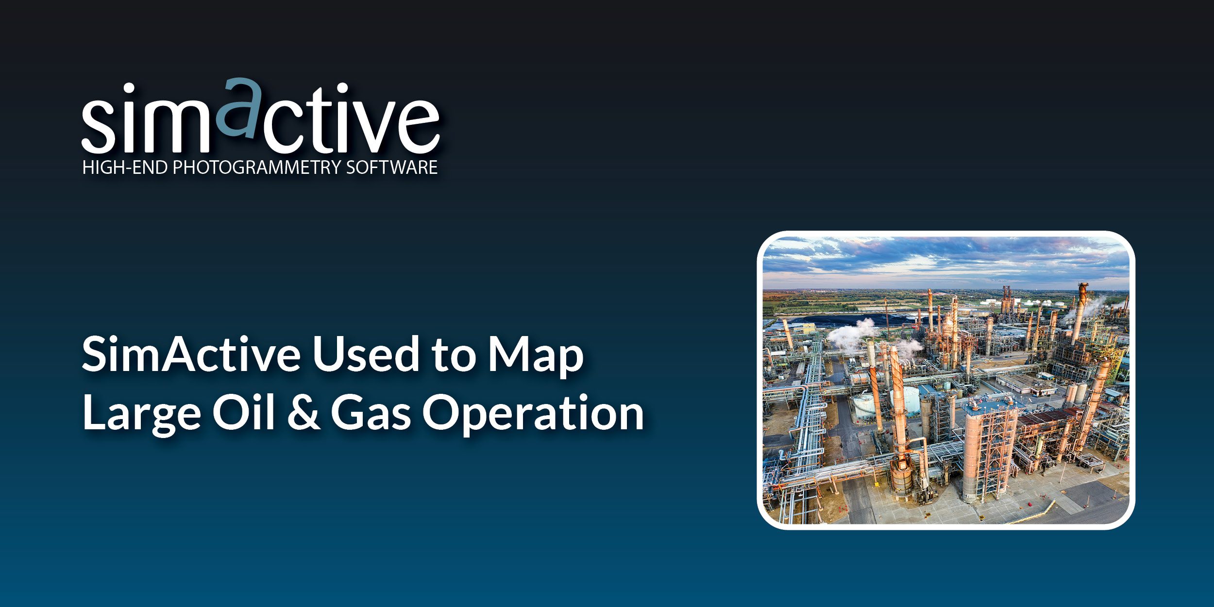
SimActive Inc.’s Correlator3D software is being used by Air Data Solutions (ADS) to map large oil and gas operations in South Texas. By integrating Phase One camera systems, ADS captures thousands of high-resolution images annually to produce detailed digital maps.

Streamlining Aerial Mapping with Correlator3D

ADS operates a fleet of 20 aircraft equipped with multiple Phase One camera systems. For its oil and gas mapping operations, ADS captures more than 3,000 images using the iXM-RS280F camera. This camera provides a large coverage area while maintaining the required ground sample distance (GSD).

“We chose the iXM-RS280F because it can capture such a large footprint and yet still achieve the GSD required for the project,” said Don Cummins, President of ADS. “Being able to import IIQ data into Correlator3D’s workflow saves us a lot of time in processing and the need for additional storage space. Working with Phase One and Correlator3D just makes our job much easier.”

Correlator3D simplifies processing by allowing the direct import of Phase One’s IIQ image format, reducing file conversion steps. The software generates essential geospatial products, including digital surface models (DSMs), point clouds, and orthomosaics.

Efficient Data Processing for Large-Scale Projects

By leveraging Correlator3D’s processing speed and GPU-powered architecture, ADS can manage large datasets efficiently. This capability is crucial for recurring mapping operations over vast regions, where quick turnaround times and accurate outputs are essential for decision-making.

About Air Data Solutions

Air Data Solutions specializes in aerial mapping and data-focused delivery. Founded by Don Cummins, a former pilot, ADS provides clients with precise and actionable geospatial information. The company develops custom software and systems to help clients make informed decisions. For more information, visit www.airdatasolutions.com.

About SimActive

SimActive develops Correlator3D™, an advanced photogrammetry solution for generating high-quality geospatial data from aerial and satellite imagery, including drone-captured data. The software supports aerial triangulation, digital surface modeling, terrain modeling, orthomosaic generation, and 3D feature extraction. Correlator3D is designed for speed and scalability, helping users process large datasets efficiently. For more details, visit www.simactive.com.

Want DRONELIFE news delivered to your inbox every weekday?  Sign up here.

Read more:

  • SimActive’s Correlator3D™ 10.3: Revolutionizing Large-Scale Mapping with Enhanced Speed and Flexibility
  • Mastering Drone Mapping: Expert Tips for Success from SimActive’s Eric Andelin
  • SimActive Software Enhances Construction Mapping for Bullseye Construction


Miriam McNabb

Miriam McNabb is the Editor-in-Chief of DRONELIFE and CEO of JobForDrones, a professional drone services marketplace, and a fascinated observer of the emerging drone industry and the regulatory environment for drones. Miriam has penned over 3,000 articles focused on the commercial drone space and is an international speaker and recognized figure in the industry.  Miriam has a degree from the University of Chicago and over 20 years of experience in high tech sales and marketing for new technologies.
For drone industry consulting or writing, Email Miriam.

TWITTER:@spaldingbarker

Subscribe to DroneLife here.

Filed Under: Drone News, Drone News Feeds, News Tagged With: aerial mapping, Air Data Solutions, correlator3d, digital surface models, geospatial data, oil and gas mapping, orthomosaics, Phase One cameras, photogrammetry software, SimActive

Reader Interactions

Leave a Reply Cancel reply

Your email address will not be published. Required fields are marked *

Primary Sidebar

LATEST

DroneDeploy Launches Progress AI to Automate Construction Tracking

New AI tool delivers accurate jobsite updates in minutes, saving time and reducing risk DroneDeploy Introduces AI-Powered Construction Progress Tool…

Continue Reading DroneDeploy Launches Progress AI to Automate Construction Tracking

Hands-On Learning, Public Safety Take Center Stage at Commercial UAV Expo 2025

Partnerships with Pilot Institute and AIRT Bring Comprehensive Training for Drone Pilots and First Responders The Commercial UAV Expo 2025…

Continue Reading Hands-On Learning, Public Safety Take Center Stage at Commercial UAV Expo 2025

Blueflite Drones to Deliver Auto Parts in Detroit

Michigan-Backed Pilot Project Aims to Modernize Automotive Logistics with Aerial Delivery A New Era of Auto Parts Delivery In a…

Continue Reading Blueflite Drones to Deliver Auto Parts in Detroit

Amprius Delivers Next-Gen SiCore® Batteries to Leading Drone Manufacturers

High-energy cells support long-endurance UAV missions for Airbus subsidiary AALTO and others Amprius Expands Drone Battery Shipments from Fremont Pilot…

Continue Reading Amprius Delivers Next-Gen SiCore® Batteries to Leading Drone Manufacturers

Solid State Batteries: A Disruptive Force in the Commercial and Dual-Use Drone Market

Battery Endurance: The Persistent Drone Challenge Battery life has long stood as a defining constraint in commercial and dual-use drone…

Continue Reading Solid State Batteries: A Disruptive Force in the Commercial and Dual-Use Drone Market

Drones Join the Front Lines in Deadly Texas Flood Response

Group deploys drones to search for victims in Texas Hill Country flood By DRONELIFE Features Editor Jim Magill The deadly…

Continue Reading Drones Join the Front Lines in Deadly Texas Flood Response

Tethered and Unstoppable: How Fiber-Optic Drones Are Rewriting the Rules of Battlefield Control

As radio-controlled drones face growing interference, Ukraine and Russia embrace fiber-optic UAVs for unjammable, high-precision operations. What Is a Fiber-Optic…

Continue Reading Tethered and Unstoppable: How Fiber-Optic Drones Are Rewriting the Rules of Battlefield Control

U.S. Drone Industry Investment Surges Amid Sweeping Legislative Reforms

The drone industry in the United States is experiencing a surge in investment and capital flow, as a series of…

Continue Reading U.S. Drone Industry Investment Surges Amid Sweeping Legislative Reforms

US and Ukraine Move Closer to Landmark Drone Deal

Big Plans for Drone Collaboration The United States and Ukraine are in advanced talks over a new partnership that could…

Continue Reading US and Ukraine Move Closer to Landmark Drone Deal

High Lander Launches Vega HighSite for Local Airspace Management

New solution enables safe and scalable drone operations for commercial and government sites High Lander Aviation has introduced Vega HighSite,…

Continue Reading High Lander Launches Vega HighSite for Local Airspace Management

Secondary Sidebar

Footer

SPONSORED

Inspired Flight Gremsy IF800 VIO F1 drones geo week

What Will It Take to Strengthen U.S. Drone Manufacturing? A Conversation with Inspired Flight’s CEO

Global Mapper Mobile data collection

Collection Ground Control Points with Global Mapper Mobile

Military Drone Mapping Solutions

How SimActive’s Correlator3D™ is Revolutionizing Military Mapping: An Exclusive Interview with CEO Philippe Simard

Photogrammetry Accuracy Standards

SimActive Photogrammetry Software: Enabling Users to Meet Accuracy Standards for Over 20 Years

NACT Engineering Parrot ANAFI tether indoor shot

Smart Tether for Parrot ANAFI USA from NACT Engineering

Blue Marble, features global mapper, features Blue Marble

Check Out These New Features in Global Mapper v25 from Blue Marble

About Us | Contact Us | Advertise With Us | Write for Us | Privacy Policy | Terms of Service

The Trusted Source for the Business of Drones.

This website uses cookies and third party services. By clicking OK, you are agreeing to our privacy policy. ACCEPT

Manage consent

Privacy Overview

This website uses cookies to improve your experience while you navigate through the website. Out of these, the cookies that are categorized as necessary are stored on your browser as they are essential for the working of basic functionalities of the website. We also use third-party cookies that help us analyze and understand how you use this website. These cookies will be stored in your browser only with your consent. You also have the option to opt-out of these cookies. But opting out of some of these cookies may affect your browsing experience.
Necessary
Always Enabled
Necessary cookies are absolutely essential for the website to function properly. These cookies ensure basic functionalities and security features of the website, anonymously.
CookieDurationDescription
cookielawinfo-checkbox-analytics11 monthsThis cookie is set by GDPR Cookie Consent plugin. The cookie is used to store the user consent for the cookies in the category "Analytics".
cookielawinfo-checkbox-functional11 monthsThe cookie is set by GDPR cookie consent to record the user consent for the cookies in the category "Functional".
cookielawinfo-checkbox-necessary11 monthsThis cookie is set by GDPR Cookie Consent plugin. The cookies is used to store the user consent for the cookies in the category "Necessary".
cookielawinfo-checkbox-others11 monthsThis cookie is set by GDPR Cookie Consent plugin. The cookie is used to store the user consent for the cookies in the category "Other.
cookielawinfo-checkbox-performance11 monthsThis cookie is set by GDPR Cookie Consent plugin. The cookie is used to store the user consent for the cookies in the category "Performance".
viewed_cookie_policy11 monthsThe cookie is set by the GDPR Cookie Consent plugin and is used to store whether or not user has consented to the use of cookies. It does not store any personal data.
Functional
Functional cookies help to perform certain functionalities like sharing the content of the website on social media platforms, collect feedbacks, and other third-party features.
Performance
Performance cookies are used to understand and analyze the key performance indexes of the website which helps in delivering a better user experience for the visitors.
Analytics
Analytical cookies are used to understand how visitors interact with the website. These cookies help provide information on metrics the number of visitors, bounce rate, traffic source, etc.
Advertisement
Advertisement cookies are used to provide visitors with relevant ads and marketing campaigns. These cookies track visitors across websites and collect information to provide customized ads.
Others
Other uncategorized cookies are those that are being analyzed and have not been classified into a category as yet.
SAVE & ACCEPT