
SimActive and Applanix Experts to Discuss the Role of High-Accuracy Positioning in Aerial Mapping Register for the Webinar:Thursday, June 12 | Two Live Sessions: 10 AM CET and 10 AM PSTRegister here SimActive will host a live interview on Thursday, June 12, bringing together two industry experts to explore the impact of advanced positioning systems on mapping accuracy. The … [Read more...] about Does Better Positioning Really Improve Mapping Accuracy?
aerial mapping
SimActive Releases Correlator3D Version 10.4 with Enhanced 3D Model Controls
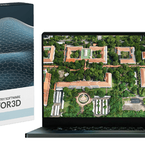
New Update Offers Greater Flexibility for Photogrammetry and LiDAR Workflows SimActive Inc., a leading developer of photogrammetry software, has released Version 10.4 of its Correlator3D platform. This new version gives users more control over 3D model creation, with advanced tools for both photogrammetry and LiDAR data. Full Control for Diverse Workflows Correlator3D … [Read more...] about SimActive Releases Correlator3D Version 10.4 with Enhanced 3D Model Controls
SimActive and Air Data Solutions Enhance Oil & Gas Mapping with High-Resolution Aerial Imagery

Correlator3D and Phase One Cameras Support Large-Scale Mapping Operations SimActive Inc.’s Correlator3D software is being used by Air Data Solutions (ADS) to map large oil and gas operations in South Texas. By integrating Phase One camera systems, ADS captures thousands of high-resolution images annually to produce detailed digital maps. Streamlining Aerial Mapping with … [Read more...] about SimActive and Air Data Solutions Enhance Oil & Gas Mapping with High-Resolution Aerial Imagery
Wingtra Unveils WingtraGROUND: A Seamless Ground Control Solution for Drone Surveying
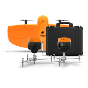
New all-in-one system integrates drone, field setup, and processing to simplify high-accuracy aerial mapping for surveyors of all experience levels. by DRONELIFE Staff Writer Ian J. McNabb Zurich, Switzerland-based drone developers Wingtra recently announced their new WingtraGROUND system, a new ground-control solution designed for the surveying space that combines “drone, … [Read more...] about Wingtra Unveils WingtraGROUND: A Seamless Ground Control Solution for Drone Surveying
SimActive’s Correlator3D™ 10.3: Revolutionizing Large-Scale Mapping with Enhanced Speed and Flexibility
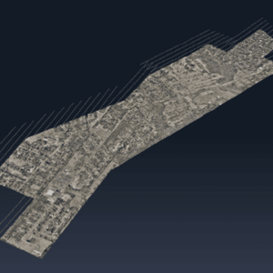
The latest update tackles big data challenges with optimized workflows and multi-platform integration, delivering powerful solutions for commercial and military applications. by DRONELIFE Staff Writer Ian J. McNabb Quebec-based software developer SimActive Inc. recently announced the release of the new Correlator3D™ Version 10.3, updating their popular mapping solution to … [Read more...] about SimActive’s Correlator3D™ 10.3: Revolutionizing Large-Scale Mapping with Enhanced Speed and Flexibility


