Drones are rapidly becoming indispensable tools for law enforcement, not only for real-time situational awareness and Drone as First Responder (DFR) programs, but also for post-incident documentation and analysis. A recent case study from Blue Marble Geographics, featuring the Windham, Maine Police Department, illustrates how drone mapping is revolutionizing crash … [Read more...] about Drone Mapping Transforms Police Crash Investigations: A Blue Marble Geographics Case Study
Blue Marble Geographics
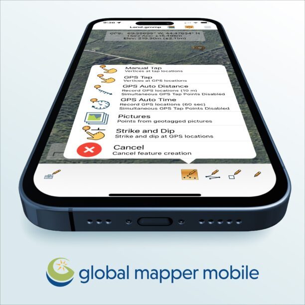
Collection Ground Control Points with Global Mapper Mobile
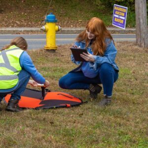
Effortless Field Data Collection with Global Mapper Mobile Global Mapper Mobile brings data collection into the palm of your hand, making it easy to record ground control points and other key features on site when collecting drone-images for processing in Global Mapper desktop’s Pixels to Points tool. Available on iOS and Android mobile operating systems, Global Mapper Mobile … [Read more...] about Collection Ground Control Points with Global Mapper Mobile
Check Out These New Features in Global Mapper v25 from Blue Marble
Top New Features in Global Mapper v25 Continue reading below, or listen: DroneLife · Blue - Marble - New - Features - Global - Mapper - Pro Blue Marble Geographic’s flagship software, Global Mapper Pro, is an all-in-one GIS package for analyzing and processing vector, terrain, image, and point cloud data. A comprehensive and easy-to-use GIS application that provides an … [Read more...] about Check Out These New Features in Global Mapper v25 from Blue Marble